
Plymouth First Minnesota City To Conduct ‘Smart Tree Inventory’
A city has a lot to maintain, whether it’s streets or stop signs. But there’s something else to maintain that many of us often take for granted.
“People take it for granted. When you lose your canopy in a neighborhood, everyone notices,” said Plymouth City Forester Paul Buck.
Buck has been in charge of preserving trees in parks and on city rights-of-way. It’s been a challenge to say the least.
“Right now, I couldn’t tell you where the worst 10 percent, 20 percent, even 50 percent of the worst trees are,” said Buck.
There’s a lot of ground to cover and a lot of trees to maintain.
“Nobody likes when storms hit and we lose a bunch of trees,” said Buck. “If we can get ahead of that game and start the maintenance on the worst ones, and maybe we can save a few of those from failing in the next storm.”
‘Smart Tree Inventory’ To the Rescue
Now, Buck’s job is about to get more efficient.
The city has partnered with Davey Resource Group and Greehill to conduct what’s called a “smart tree inventory.” Plymouth is the first city in Minnesota to do so, signing a four-year, $300,000 contract with the two companies for the high-tech tree survey.
The survey deploys vehicles equipped with computers and 3D mapping scanners. The technology will allow the city to take inventory of every tree on city property. It will take two to three weeks to collect all the data.
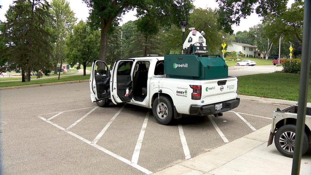
Vehicle used by Greehill that provides a 3D scan of trees.
Once collected, the data will give a complete picture of Plymouth trees — everything from size and type to age and health.
The measurements are much more accurate than what the city has ever had before.
“Historically, we were using on-the-ground arborists that were maybe making estimates, ranges of those, maybe laser range finders, which still have a component of human error, because you’re relying on your eye and where you’re shooting that laser,” said Jacob McMains with Davey Resource Group. “This LiDAR data and machines can take all those metrics so much more accurately.”
LiDAR stands for light detection and ranging, a remote sensing technology that uses laser light to create highly detailed 3D models of objects. Data collected from the technology will eventually help the city decide where to prune and where — and what — to plant.
“We’ll get to see what our palette of trees is. Where are we too invested in a certain species? Versus where, if we’re going to replant trees or put new trees in, where are some species we could put in to bump that diversity back up,” said Buck.
Buck said the technology will also help the city to decide what areas to focus on in the future.
“Even though, right now, everything looks great and they’re fully canopied, we’ve got a lot of old trees in this neighborhood. I know you’re not thinking beyond 5-10 years, but we need to think 30-40 years. That’s kind of exciting.”
The companies partnering with Plymouth will eventually rescan all the city’s trees in two years to assess the city’s efforts and see the progress made.
Also see: Maple Trees Turning Colors Early Due to Excessive Moisture